Serving Gogebic, Iron and Ontonagon Counties
Serving Gogebic, Iron and Ontonagon Counties
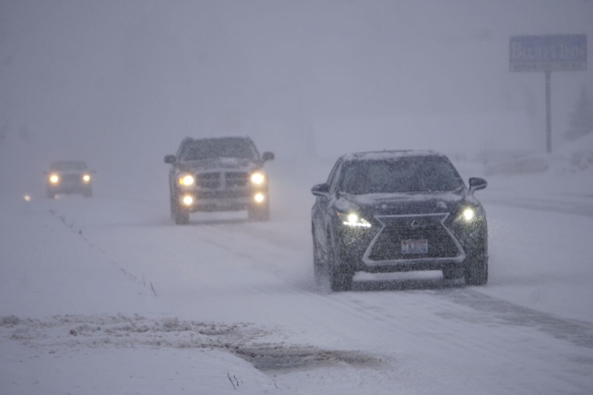
Drivers heading west out of Bessemer on U.S. 2 experience slippery roads and low visibility during a Monday snowstorm over the much of the west and central Upper Peninsula.
By TOM LAVENTURE
Ironwood - The snowstorm that struck the region on Monday afternoon came a bit later than predicted with heavy snow falling in the evening instead.
Jacob Horton, a meteorologist with the Weather Service, said there was heavy snow falling as forecasted but that reported measurements were falling short of what was expected by mid-afternoon Monday. The 4 p.m. public report from Ironwood measured 4.3 inches with snow expected to continue in the evening when it was falling heavily.
"We are gathering the reports and the snow appears to be a little under what was predicted," Horton said. "We're updating the forecast right now."
The lake-effect snow might bring another inch or two of snow today, he said.
The National Weather Service in Marquette issued a hazardous weather outlook for much of the western and central Upper Peninsula at 3:20 p.m. Monday through 1 a.m. today. The counties under the bulletin included Gogebic, Ontonagon, Keweenaw, Iron, Houghton, Baraga, Marquette and Dickinson counties. The bulletin also included all of north and central Wisconsin and the north shore of Minnesota.
"So far the roads are just pretty much slick and icy underneath, making for poor driving with visibility less than a quarter mile," said Deputy Adam Graser of the Gogebic County Sheriff's Office at around 3 p.m. Monday.
He said there weren't any calls yet about accidents or cars in the ditch at the time of his statement.
"We've been lucky," Graser said.
The Sheriff's Office also said they received word that Monday's 4:05 p.m. Air Choice One flight to Minneapolis was canceled.
Scattered power outages are possible due to heavy snow accumulations on trees and power lines. Large waves on Lake Superior were expected and could cause beach erosion and shore flooding.
The low pressure system came from the central plains over the upper Great Lakes, Horton said. The center of the low pressure is moving toward eastern Lake Superior, he said.
The snow showers today should wind down around 10 a.m., according to the Weather Service. The high should be near 24 degrees with a low around 8 degrees overnight into Wednesday with wind chill values between zero and 5 degrees.
New Year's Day should be partly sunny, with a high near 28 degrees, and a low around 22 degrees.
Thursday will be mostly cloudy with a high near 36 degrees and a low around 27 degrees with a chance of rain and snow mix overnight into Friday with a chance of more snow through Sunday with temperatures ranging from the teens to the low 30s.